Belfort | |
|---|---|
Former mining camp | |
 Belfort Location in California  Belfort Belfort (the United States) | |
| Coordinates: 38°24′59″N 119°16′02″W / 38.41639°N 119.26722°W | |
| Country | United States |
| State | California |
| County | Mono County |
| Elevation | 3,112 m (10,210 ft) |
Belfort was a mining camp in the 1880s.[2] It was located 8.5 miles (14 km) east-northeast of Fales Hot Springs,[2] at an elevation of 10210 feet (3112 m)[1] in the Sweetwater Mountains.[3]
Mining activity for silver and gold continued into the 1890s.[4]
References
- 1 2 U.S. Geological Survey Geographic Names Information System: Belfort, California
- 1 2 Durham, David L. (1998). California's Geographic Names: A Gazetteer of Historic and Modern Names of the State. Clovis, California: Word Dancer Press. p. 1146. ISBN 1-884995-14-4.
- ↑ "Belfort, Boulder Flat & Star City, California: Sweetwater Sister Towns". Nevada Ghost Towns and Beyond. July 21, 2021.
- ↑ Evans, Cat. "Belfort". ghosttowns.com.
Municipalities and communities of Mono County, California, United States | ||
|---|---|---|
| Town | 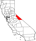 | |
| Census-designated places | ||
| Unincorporated communities | ||
| Indian reservations | ||
| Former settlements | ||
This Mono County, California-related article is a stub. You can help Wikipedia by expanding it. |